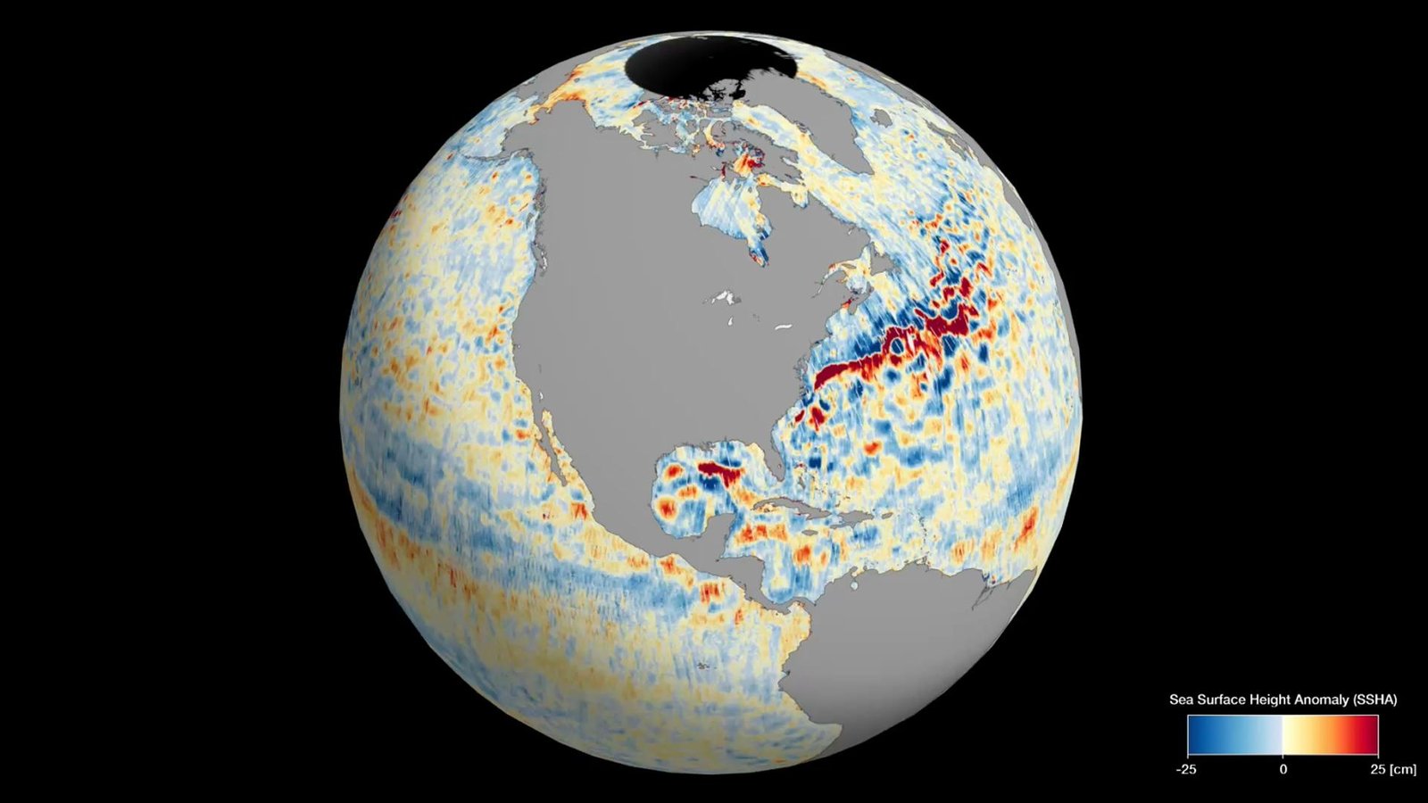
NASA’s Surface Water and Ocean Topography (SWOT) satellite has successfully mapped nearly all of Earth’s water. This is the first time that such a comprehensive map of the planet’s water resources has been created. The images showcase almost all of the Earth’s water in fresh maps of the planet’s worldwide sea levels.
These visuals were generated using data from the Surface Water and Ocean Topography (SWOT) satellite. The data captures the dynamic surface elevations of the Earth’s oceans, as well as its freshwater lakes and rivers.
The SWOT satellite was launched in December 2022. It is a joint mission between NASA and the French space agency CNES. The satellite carries a radar instrument that can measure the height of water surfaces with an accuracy of a few centimetres.
SWOT data is being used to create a global map of water surface elevation. This map will be used to track changes in water levels over time, which can be used to study climate change, drought, and flooding.
This information was acquired during SWOT’s initial 21-day science orbit, commencing on July 26 and concluding on August 16, as confirmed by NASA.
Why is SWOT important?
As the Earth’s climate changes, the distribution of water on the planet is also changing. This is leading to changes in water availability in some areas, while other areas are experiencing more frequent floods.
SWOT embarked on its space journey on December 16, 2022, through a SpaceX Falcon 9 rocket launch from Space Launch Complex-4E at Vandenberg Space Force Base in California. This Earth-observing satellite is the result of a collaborative effort between NASA and the French Space Agency (CNES).
The SWOT satellite data will help us to better understand these changes and to develop strategies for adapting to them. Parag Vaze emphasized that the data acquired by SWOT will propel research into the consequences of climate change and support communities worldwide in better preparing for a warming planet.
Throughout its mission, the spacecraft, positioned at an altitude of approximately 533 miles (857 kilometres) above Earth, will periodically gauge water height over more than 90% of the planet’s surface, monitoring alterations in global water levels.
How does SWOT work?
The SWOT antennas are 33 feet (10 meters) apart and are part of the Ka-band Radar Interferometer (KaRIn) instrument. KaRIn observes and measure the height of water in Earth’s freshwater bodies and the ocean the instrument will be able to see small-scale characteristics like eddies, currents, and other features less than 13 miles (20 kilometers) across.
KaRIn will also focus on Earth’s bodies of water like lakes, rivers wider than 330 feet (100 meters) across, and even reservoirs that are larger around 62,500 square meters.
It collects data by bouncing radar pulses off the surface of Earth’s water and collecting the signals with its antennas. This data-collecting area sweeps out to around 30 miles (50 kilometers) from either side of SWOT.
Once fully operational NASA says that the data SWOT provides will assist scientists and politicians to address the pressing problem of climate change in order to help various communities prepare for a warmer climate and the challenges it will bring.
What are the benefits of this new map?
The scientific community is already buzzing with excitement over the wealth of information the satellite has delivered. Parag Vaze, the SWOT project manager at NASA’s Jet Propulsion Laboratory in Southern California, lauded the level of detail that SWOT is transmitting regarding sea levels across the globe.
The new map of Earth’s water will have a number of benefits, including improved understanding of the global water cycle. The map will help us to better understand how water moves around the planet. This information can be used to develop better models of climate change and to predict how water resources will be affected. The map can be used to identify areas where water resources are scarce and to develop strategies for managing water more effectively.
The maps can be used to identify areas that are at risk of flooding or drought. This information can be used to prepare for and respond to these disasters.
The Future of SWOT
The SWOT satellite is expected to continue collecting data for at least three years. This data will be used to improve the accuracy of the global map of water surface elevation and to track changes in water levels over time. The data will also be used to develop new applications, such as water quality monitoring and flood forecasting.
According to NASA officials, disparities in sea levels can highlight ocean currents, such as the Gulf Stream off the U.S. East Coast or the Kuroshio Current along the east coast of Japan. Sea surface height can also signal areas of relatively warmer water, like the eastern section of the equatorial Pacific Ocean during an El Niño event, as water expands as it warms.
The SWOT satellite is a valuable tool for understanding and managing Earth’s water resources. The new map of Earth’s water will have a number of benefits for science, water management, and disaster response.