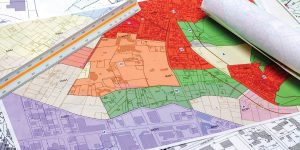
Measuring Mount Everest
With the help of cutting-edge surveying technology, the Nepal Survey Department measured the height of Sagarmatha, or the Mount Everest, and will soon reveal how high the world’s highest mountain is.
The Virtual Singapore platform is a digital twin of the city-state of Singapore. It enables users from different sectors to develop sophisticated tools and applications for…
The United States Geological Survey (USGS), under its 3D Elevation Program (3DEP), has set the goal to complete nationwide data acquisition in eight years.
Gaofen-1, the first Chinese high-definition EO satellite has revealed vast stretches of supposedly illegal hemp plantations and many cross-border tunnels.
Datastory’s dashboard integrates different data layers to provide situational awareness on key retailers, urgent care, hospitals, pharmacies, etc. View the MapDash for COVID-19 Dashboard
USA: Trimble has announced a new high-performance field computer for its Mapping and Geographic Information Systems (GIS) portfolio—the Trimble TDC150 handheld. Designed for GIS data collection, inspection
Designated GPS IIR-20(M), the satellite is the seventh in a line of eight GPS IIR satellites that Lockheed Martin Navigation Systems, has modernised for its customer, the Global Positioning Systems Wing, Space and Missile Systems Center, Los Angeles Air F
© Geospatial Media and Communications. All Rights Reserved.