


Critigen’s new brand reflects not only how we have changed as a company but how I believe our industry has entered an exciting new era. We are now Locana, a name that reflects the indispensable role that location-based intelligence is poised to play across every industry and in so many areas of people’s lives. The new name is based on the Latin words for place (locus) and information about a place (ana), which signifies how universal location information is and the power of the insights it can deliver.
Location intelligence — the actionable insights derived from that data — has the power to profoundly change how companies do business, the way people live their lives, and the way people solve the most challenging problems that humanity faces. This moment has been decades in the making as the geospatial industry has collectively built the foundation for a new era of location intelligence.
I am proud of Critigen’s legacy of helping build that foundation over the past 20-plus years. Our company has had a major focus on innovation for the past few years in anticipation of this broader role for geospatial technology, and changing our name is the final step in the company’s reinvention to help organizations use location intelligence to achieve their missions.
Critigen has had a long, successful history helping companies put geospatial information to work by providing technology consulting, complex data analysis, modeling, systems development, and project controls to clients across industries and around the world. We’re building on that legacy by playing the same role of trusted partner as companies prepare to put location intelligence to work in every aspect of their operations. Our industry has a unique opportunity to change the world for the better, and I don’t say that lightly. This technology is capable of solving some of the most difficult challenges around the world.
Our team is inspired by that vision and is committed to put the power of location-based insights into everyone’s hands in a way that is simple to use and impactful. Everyone in our company is focused on that mission, and the name change reflects our commitment to lead this new era.
The first trend is the exponential growth of location data that is coming from all of the sensors, devices and other connected systems that generate vital location- based intelligence. That data, combined with the wealth of third-party open-source data that is available, has important insights that organizations know they need — if only they could extract them and make them actionable. We help them do exactly that.
The second trend is new user demands and use cases that are making location-based technology a must-have rather than a nice-tohave. Digital maps are now an indispensable part of applications that each of us use every day, whether that is getting driving directions or finding the nearest Starbucks. Users not only understand how to use this technology, but also expect information and features to be delivered to them via these visual interfaces. User demand is intersecting with the exploding number of use cases that exist in every industry globally. Digital maps and location intelligence are the only ways to solve so many of the challenges that organizations face, and users now have the familiarity with this technology for it to be used on a mass scale. People in all walks of life are ready to use this technology, and that is a powerful trend for us to tap into as an industry.
The last trend is just as important. It is the elevated expectation for enterprise-grade solutions that are truly easy to use and actionable. More than ever, there is a belief that all technology should be as easy to use as smartphone apps and that it should empower workers with real-time, actionable insights. Geospatial technology has reached an important inflection point where it can do exactly that, which is what is ushering in this new era of location intelligence.
Location-based data and insights have become mission critical for organizations responding to events like natural disasters, disease outbreaks, refugee crises, and other fast-moving emergencies. And you don’t have to look far to see examples of that. Digital maps that communicate real-time information are one of the most powerful tools that governments, NGOs, news organizations, and the public have had during the pandemic to track outbreaks, vaccination campaigns, and more. It’s no understatement to say that location intelligence is now indispensable to global public health initiatives like the fight against COVID-19.
Digital maps and location-based information are also at the heart of how the world is following and responding to the war in Ukraine. And it is part of nearly every climate change-related initiative I am seeing today. Location- based information is not only fundamental to how we understand those emergencies but also how we collectively take action to respond to them. This is the vision that so many of us had decades ago at the beginning of the geospatial industry, and it is now coming to fruition.
I’m so glad you asked this because Artificial Intelligence (AI) is a force multiplier that is enabling location-based data to have a much larger impact on our world. Geospatial experts will always be essential because of the unique combinations of expertise and analytical abilities they possess. AI can never replace that, but it can perform data processing and automated analysis on a scale that has never been possible before. That is particularly important given the tsunami of data that is coming from all of those devices you mentioned.
We would need a galaxy of geospatial experts to process and analyze that data if not for AI-driven analytic engines. Just as importantly, AI-driven location intelligence can also deliver those insights in ways that are appropriate, easily consumable and clear in the kind of actionable guidance they provide to each user. That is a powerful complement to the work that geospatial teams do, plus it allows those experts to focus on higher-level analysis that delivers even more value to their organizations.
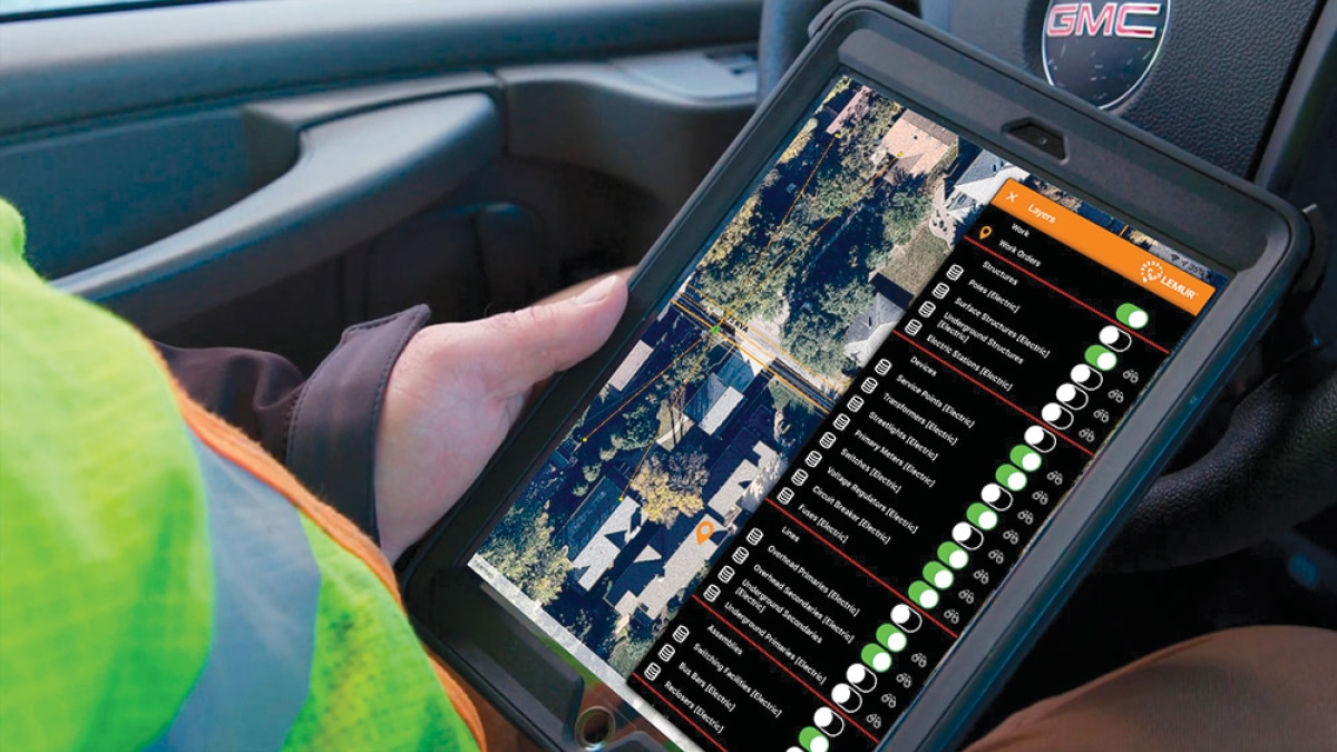
Some of the most exciting and impactful applications of location intelligence rely on the kind of performance that 5G networks provide. Most of what is written about 5G is focused on consumer examples like gaming and virtual reality and streaming, but the impact on geospatial-driven applications is just as significant. So many of the applications our team is working on with customers depend on ultra-low latency and high data transfer via a cell connection.
A great example of that is utility workers who are working in the field whether it is a routine maintenance check or an emergency response after an outage. The combination of location intelligence and 5G connectivity gives them real-time information and insights for their workflows that makes them safer, more productive, more accurate, and faster. The same story is playing out in other industries and in consumer technology, where the combination of 5G with location-driven applications on smartphones turns every iPhone and Galaxy into a powerful tool for geospatial-driven applications.
This is such an important question because it is so fundamental to modern life. Businesses and individuals have never had more powerful tools at their fingertips, but the pace of technological advancements is moving way faster than people’s ability to use them and benefit from them. Geospatial technology is a perfect example. The number of devices that produce location- based data is growing exponentially as more and more sensors and connected devices are deployed by companies in every industry, government agencies, state and local government entities, NGOs, and the public. That is producing a volume of information that was unimaginable a few years ago, but data is just data.
What we all truly need are insights that we can easily consume and put into action. That is exactly what location intelligence delivers, which is why I am so excited about this new era we are entering. By automating the process of converting that wave of data into exactly the insights people need, we can eliminate that gap between the pace of technology and people’s ability to use it.
I’ve been thinking a lot about the future lately, and I want to close by saying I am hopeful despite how dark so many things are in the headlines today and over the past couple of years. I am hopeful because people around the world have never had as many tools to make a positive difference as they do right now.
I believe that location-based data and insights are one of the most powerful tools for collectively solving so many of the most difficult challenges around the world, to poverty and public health emergencies. This is not hyperbole. It’s happening today, and I’m really proud of the work our team is doing to support organizations doing that important work, whether it is fighting climate change in the rain forests and critical wetlands or helping developing nations with emergency healthcare. That is something for everyone in our industry to be proud of because we have all built the foundation that has made that possible.