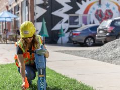
Daily tons of utility location data is produced all across the globe but its effective management is among the biggest challenge that stakeholders continue to face.
“In the United States and throughout the world, government agencies are looking for a system that can serve as a centralized database which can take all of this data that’s currently available and manage it on one single platform and then provide the ability to share that data whenever its needed by the various stakeholders including whenever it is updated or when any discrepancies are found,” said Mr. Page Tucker, CEO ProStar Geocorp, Inc., during a recent discussion with Geospatial Media and Communications.
Several initiatives have been witnessed especially in developed economies such as the U.S., U.K, Singapore, and the Netherlands where they are developing a central platform to collate and visualize the subsurface utility infrastructure. One such data management initiative is that of the Colorado Department of Transport (CDOT).
Also Read: Schneider Digital’s new 3D PluraView 24“ Full HD Monitor is here!
Colorado Department of Transportation (CDOT) Initiative
CDOT is among the few transport organizations all across the globe that is providing Quality Level B information of the subsurface utility infrastructure to its construction contractors in the bidding stage of any new construction project. Using Prostar’s Pointman and Transparent Earth solutions, they are digitizing results obtained during SUM operation and also ensuring that if a new subsurface infrastructure is being built, its as-builds are also being uploaded on the SaaS platform.
Mr. Page’s comments on the same were: “So in working with CDOT our goal was to create a system that can improve the current management practices of all their assets both above ground and below ground as well as other utility owners that place their assets on CDOT’s right of ways. The system would also be required to integrate into their current systems of record and also into the systems of record of the stakeholders that have assets on CDOT’s right-of-way and that provide services. This includes all the municipalities, utility owners, the pipeline companies as well Colorado 811 and the service contractors. As our population growth continues and demand for new utilities increases, their right of ways are becoming congested. An example is telecom networks such as fiber optic, which are being put into the ground at a very significant rate and required to cross over current utility networks. CDOT implemented our solution so that they can identify precisely where the current assets are located on their right of way and where these new installations are being placed so that they can improve all the business practices associated to the management of this infrastructure as well as prevent damages to it that occur far too often.

The vision of providing Quality Level B information at the bidding stage was based out of ADKAR Model.
Also Read: Smart Construction using Artificial Intelligence
ADKAR stands for Awareness, Desire, Knowledge, Ability, and Reinforcement.
Awareness
It was in January 2016 when Mr. Neil Lacey (Project Development Branch Manager) realized that it was CDOT’s primary objective to provide more accurate utility information to the construction contractors in the bidding stage which eventually led to the use of advanced SUE technologies by CDOT.
Desire
In March 2017, CDOT invited retired Indiana DOT (INDOT) Utility Engineer, Mr. Kenny Franklin to conduct a workshop on SUE with CDOT employees which aimed at uplifting their understanding of SUE and making them aware about INDOT implementation of ‘Quality Level B’ SUE on the construction projects they undertook. The workshop was followed by teleconferences between Mr. Chris Williams handling Region 3 and the SUE team at CDOT. It discussed how ‘Quality Level B’ SUE was being implemented in Region 3. The workshop and the teleconferences felicitated everyone at CDOT towards the importance of providing good quality subsurface utility information to construction contractors in the bedding stage.
Knowledge
In and around September 2017, the SUE team-initiated discussions with the Colorado Contractors Association (CCA) and the American Council of Engineering Companies (ACEC) to engage with various states in understanding the practices they followed to understand the subsurface infrastructure. It was this collective discussion that helped CDOT framing its regulations for SUE. During the 2018 Legislative Session for Subsurface Utility Engineering (SUE), the plans to improve utility information was presented. Its bill was presented in February 2018 to the legislature and was passed in May 2018(SB 18-167). The bill was aimed at providing quality levels as per ASCE 38 standard for the upcoming construction projects undertaken by CDOT. This new legislation became live on August 8th, 2018.
Ability
After this, CDOT started providing subsurface utility information as per SB 18-167 initially for the previously ongoing projects and then to the new once. The responsible personnel who provided CDOT’s engineering plans were required to provide Quality Level B information about the subsurface.
Reinforcement
CDOT is engaged in collecting, processing and depicting utility data for CDOT projects. The use of PointMan and Transparent Earth products from ProStar Geocorp are the latest tools and technologies used by CDOT for the same.
Mr. Rob Martindate, Program Manager – Utilities/Railroads at CDOT during a discussion with Geospatial Media and Communication said “We were looking for something that was GIS but also had some survey type functionality. We chose the PointMan mobile app which included the TransparentEarth – a GIS dashboard platform. These solutions focused on utility mapping but included the ability to pull high accuracy GIS utility data into their system. They had the foresight to see that capturing GNSS positional records was important for qualifying the data. I started to see the ProStar technology was user friendly and the possibility of training field technicians and construction managers to use this technology was a reality. And that’s how we mandated the use of this technology to collect utility data for whosoever is working on CDOT’S project.”

CDOT’s initiative to provide Quality Level B information at the bidding stage of construction of any new infrastructure has indeed been an eye-opener for DOT’s all across the globe. Such initiatives not only ensure a smooth transfer of underground knowledge to construction contractors but will also assure the availability of concrete underground data when new construction takes place in the same vicinity.
In conclusion, from CDOT’s example, if good quality and reliable subsurface utility information is given to construction contractors in the bidding stage, the need of doing subsurface utility mapping by construction contractors (in the planning and designing phase) shall reduce to some extent in future. This will not only reduce the overall capital spent on a project but will also reduce the overall time allocated for completion of any new infrastructure project.