Human’s need of making large-scale, accurate measurements of the Earth’s surface led to the evolution of the concept of surveying. Surveying helps in determining the relative horizontal and vertical positions required for the process of mapping.
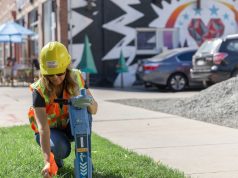
The most traditional form of surveying is Ground survey, which is carried out by field surveyors by physically visiting a site and recording important details about the area for measurement and mapping purposes. Surveyors work on a variety of projects from land subdivision and mining exploration to tunnel building and construction. Surveyors usually use equipment, such as total stations, robotic total stations, theodolites, GNSS receivers, 3D scanners, handheld tablets and subsurface locators for the purpose of surveying.
With advancements in technology, a new trend which is making prominence in the surveying and mapping industry is that of aerial survey, that is, using drones and UAVs for surveying and mapping.
A go-to solution in the new normal
Drones are getting largely integrated into surveying workflows to perform land surveys, photogrammetry, 3D mapping, topographic surveying and more. Aerial images greatly accelerate and simplify topographic surveys for land management and planning. The Indian Government’s recent Swamitva Project (Land Ownership Scheme), which was launched on April 24, 2020 is an excellent example of the growing adoption of drone surveying and mapping in land administration. The project aims to map the rural inhabited lands using drones and latest survey methods. The project will ensure streamlined planning, revenue collection and provide clarity over property rights in rural areas.
While the trend of drone surveying is already becoming mainstream, the COVID-19 pandemic has tipped the scale in its favor drastically.
UAVs have become a go-to technology in these difficult times, primarily due to their ability to accomplish tasks without contact. They have been playing a vital role in surveying and mapping areas where hospitals and COVID-19 test centers can be built and monitoring such sites. The police has also been using maps, created on the basis of drone surveys, to place physical distancing markers, deciding where to set up isolation centers, planning movement of essential items, workforce allocation, marking nearby hospitals and police stations from hotspots and the shortest routes for easy movement in case of an emergency.
Drone based maps have also been enabling the police to ensure that physical distancing norms are followed by people to restrict the spread of the virus.
In Argentina, authorities turned to drones to quickly survey sites for building a dozen modular hospitals across the country to fight the pandemic. When confirmed cases of the virus doubled in just two weeks, the authorities had to act fast. Hospitals needed to be built and made operational quickly to meet the sudden demand of approximately 1,200 beds along with ICU and isolation rooms. These hospitals were to be quickly constructed.
One of the major hurdles in getting the project done quickly was that the twelve facilities were to be built across four provinces. Drone surveys helped in bringing the project to fruition.
Using drones, twelve locations were surveyed; around 10,000 square meters were covered in only three days. Photographs from the drones were fed into the software to quickly create both 2D and 3D maps of the sites. These maps were shared on Cloud with different agencies involved in the project. This quick collection and sharing of information brought the project on feet much faster than what could have been achieved with traditional surveying methods.
Along with yielding results quickly, one of the greatest benefits of using drones in surveying is that accurate data can be achieved with lesser number of people working on the ground. In the new way of working that encourages minimal contact and reduced use of human resources on the field, drones are undoubtedly emerging as a preferred choice for surveying and mapping. A combination of ground and drove surveying can bring extraordinary precision to any project.
Realising the benefits, authorities world over are actively reconsidering the drone regulations and rethinking strategies to bring more balance between usage and safety. The future seems quite promising for drone and UAV manufacturers and aerial mapping solution and software providers.
Also Read: How fear-based regulations hurt the drone industry: Brendan Schulman, DJI